
🔥🌍 AI for Wildfire Detection and Prediction: From Satellites to Risk Models
Recent research shows that AI models can detect wildfires earlier and estimate fire risk by combining satellite imagery, weather data, and environmental factors.
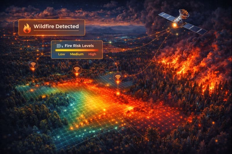
Why This Study Matters
Wildfires are becoming more frequent and severe due to climate change. Early detection and accurate risk prediction are critical for saving lives and ecosystems. Traditional methods rely heavily on weather forecasts, while AI can integrate many additional signals.
What Researchers Proposed
Researchers developed AI systems that combine multiple data sources to detect and predict wildfires.
These models analyze patterns across space and time rather than relying on single indicators.
Key features include:
- Satellite image analysis for early fire detection
- Integration of weather, vegetation, and terrain data
- Probabilistic fire risk estimation
Study Summary
| Aspect | Details |
|---|---|
| Data Sources | Satellites, weather records, land data |
| Model Type | Machine learning risk models |
| Tasks | Detection and probability forecasting |
| Evaluation | Historical wildfire events |
Real Data Highlights
- Earlier detection compared to manual monitoring
- Improved prediction of high-risk regions
- Better performance than weather-only models
- Useful uncertainty estimates for decision-making
Key Insights
- Multi-Signal Learning: Combining data sources improves accuracy.
- Early Warning: Faster detection enables quicker response.
- Risk Awareness: Probabilistic outputs support planning.
Real-World Benefits
| Scenario | AI Advantage |
|---|---|
| Emergency response | Faster alerts |
| Land management | Targeted prevention |
| Climate adaptation | Improved risk assessment |
Limitations
- Satellite coverage gaps can affect detection
- Extreme events remain hard to predict
- Models require continuous data updates
Summary
AI-based wildfire systems provide valuable tools for early detection and risk forecasting, supporting better disaster preparedness in a changing climate.
Sources
- Jain et al. Artificial intelligence for wildfire management. Remote Sensing. 2025.
- ECMWF. Probability of Fire model overview. 2024.
Disclaimer
This article summarizes peer-reviewed research for educational purposes only.